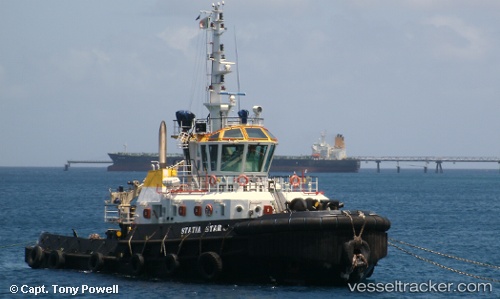
 STATIA STAR
Current Status
Where is the vessel?
STATIA STAR is currently in 17 nm SE of Guryongpo, based on AIS data received about 15h ago.
Latest AIS update:
Current position: 35.76611° N, 129.78217° E (17 nm SE of Guryongpo)
Average speed (last 7 days): Loading…
Average speed (last 30 days): Loading…
Vessel profile: STATIA STAR is a Tug with dimensions m x m.
This page combines live AIS, route history, probable destination signals, nearby traffic, and port activity for practical vessel monitoring.
The current position of vessel STATIA STAR is 35.76611 lat / 129.78217 lng. Updated: 2026-05-19 01:57:05 UTCNearest reference points:
- 23 nm SE of Guryongpo
- 21 nm E of Guryongpo
- Near Guryongpo
Currently sailing under the flag of Malta ![]()
Details:
Live Vessel STATIA STAR Analytics (details, animations, etc.)
Recent AIS points (UTC):
2026-05-18 22:44:34 UTC · 35.84820, 129.78828 · SOG 18.1 kn · COG 191°2026-05-18 23:22:46 UTC · 35.65919, 129.74806 · SOG 17.7 kn · COG 190°
2026-05-19 01:44:22 UTC · 35.69221, 129.76183 · SOG 21.4 kn · COG 10°
2026-05-19 01:57:05 UTC · 35.76611, 129.78217 · SOG 20.6 kn · COG 31°