 RUBYLAND
Current Status
Where is the vessel?
RUBYLAND is currently in Near Mugardos, based on AIS data received about 14h ago.
Latest AIS update:
Current position: 43.46531° N, 8.32072° W (Near Mugardos)
Average speed (last 7 days): Loading…
Average speed (last 30 days): Loading…
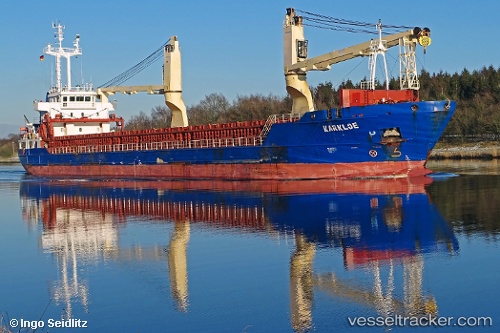
Vessel profile: RUBYLAND is a General Cargo Ship with dimensions 106m x 15m.
This page combines live AIS, route history, probable destination signals, nearby traffic, and port activity for practical vessel monitoring.
The current position of vessel RUBYLAND is 43.46531 lat / -8.32072 lng. Updated: 2026-05-18 17:58:16 UTCNearest reference points:
- Near Ferrol
- Near La Coruna
- Near Milladoiro
Currently sailing under the flag of Portugal (MAR) ![]()
RUBYLAND built in 2011 year
Deadweight:
5724 tDetails:
Live Vessel RUBYLAND Analytics (details, animations, etc.)
Recent AIS points (UTC):
2026-05-18 14:01:19 UTC · 43.46532, -8.32069 · SOG 0 kn · COG 56°2026-05-18 16:19:16 UTC · 43.46532, -8.32073 · SOG 0 kn · COG 56°
2026-05-18 16:19:16 UTC · 43.46532, -8.32073 · SOG 0 kn · COG 56°
2026-05-18 17:58:16 UTC · 43.46531, -8.32072 · SOG 0 kn · COG 56°