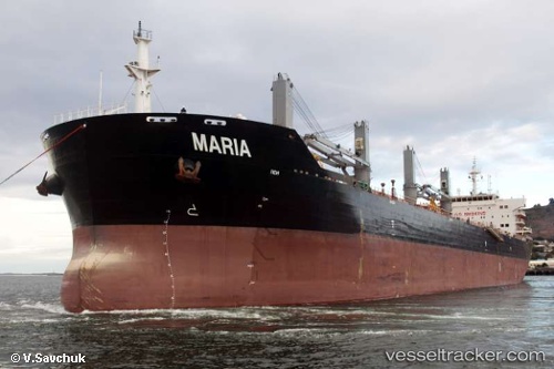
Maria
Current StatusWhere is the vessel?
Maria is currently in 32 nm NW of TENES, based on AIS data received about 14h ago.
Latest AIS update:
Current position: 36.84177° N, 0.79368° E (32 nm NW of TENES)
Average speed (last 7 days): Loading…
Average speed (last 30 days): Loading…
Vessel profile: Maria is a Bulk Carrier with dimensions 32m x 190m.
This page combines live AIS, route history, probable destination signals, nearby traffic, and port activity for practical vessel monitoring.
The current position of vessel Maria is 36.84177 lat / 0.79368 lng. Updated: 2026-05-21 05:54:14 UTCNearest reference points:
- 50 nm N of Mostaganem
- 43 nm NW of Mostaganem
- Near Mostaganem
Details:
Live Vessel Maria Analytics (details, animations, etc.)
Recent AIS points (UTC):
2026-05-21 01:44:52 UTC · 37.06007, 1.85298 · SOG 12.6 kn · COG 256°2026-05-21 04:04:23 UTC · 36.93033, 1.25207 · SOG 12.8 kn · COG 259°
2026-05-21 04:33:03 UTC · 36.90457, 1.13160 · SOG 12.3 kn · COG 262°
2026-05-21 05:54:14 UTC · 36.84177, 0.79368 · SOG 12.3 kn · COG 258°