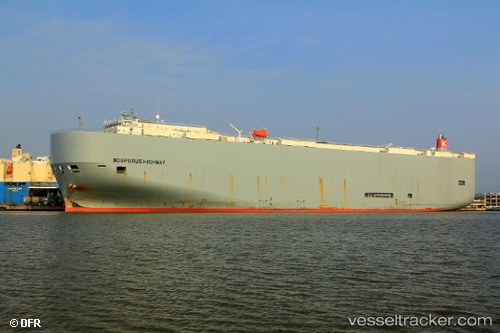
 Bosporus Highway
Current Status
Where is the vessel?
Bosporus Highway is currently in Near Luanda, based on AIS data received about 14h ago.
Latest AIS update:
Current position: 8.73554° S, 13.24080° E (Near Luanda)
Average speed (last 7 days): Loading…
Average speed (last 30 days): Loading…
Vessel profile: Bosporus Highway is a Vehicles Carrier with dimensions 199m x 199m.
This page combines live AIS, route history, probable destination signals, nearby traffic, and port activity for practical vessel monitoring.
The current position of vessel Bosporus Highway is -8.73554 lat / 13.24080 lng. Updated: 2026-05-21 09:50:04 UTCNearest reference points:
- Near Luanda
- Near Greater Plutonio
Currently sailing under the flag of Panama ![]()
Bosporus Highway built in 2009 year
Deadweight:
18792 tDetails:
Live Vessel Bosporus Highway Analytics (details, animations, etc.)
Recent AIS points (UTC):
2026-05-21 05:53:06 UTC · -8.73502, 13.24097 · SOG 0 kn · COG 256°2026-05-21 07:11:04 UTC · -8.73502, 13.24087 · SOG 0.1 kn · COG 241°
2026-05-21 07:50:05 UTC · -8.73502, 13.24086 · SOG 0.1 kn · COG 239°
2026-05-21 09:50:04 UTC · -8.73554, 13.24080 · SOG 0 kn · COG 331°