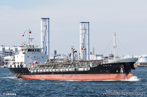
 NOJIGIKU
Current Status
Where is the vessel?
NOJIGIKU is currently in Near NYUGAWA, based on AIS data received about 15h ago.
Latest AIS update:
Current position: 33.98668° N, 133.18391° E (Near NYUGAWA)
Average speed (last 7 days): Loading…
Average speed (last 30 days): Loading…
Vessel profile: NOJIGIKU is a Chemical/Oil Products Tanker with dimensions m x m.
This page combines live AIS, route history, probable destination signals, nearby traffic, and port activity for practical vessel monitoring.
The current position of vessel NOJIGIKU is 33.98668 lat / 133.18391 lng. Updated: 2026-05-19 09:35:51 UTCNearest reference points:
- Near NYUGAWA
- Near Yoshiumi
- Near HAKATASHIMA
Currently sailing under the flag of Japan ![]()
NOJIGIKU built in 2009 year
Deadweight:
1203 tDetails:
Live Vessel NOJIGIKU Analytics (details, animations, etc.)
Recent AIS points (UTC):
2026-05-19 06:13:19 UTC · 34.38169, 133.83707 · SOG 10.7 kn · COG 251°2026-05-19 07:07:30 UTC · 34.32385, 133.64993 · SOG 11.6 kn · COG 241°
2026-05-19 08:16:41 UTC · 34.17440, 133.43095 · SOG 12.6 kn · COG 226°
2026-05-19 09:35:51 UTC · 33.98668, 133.18391 · SOG 12.7 kn · COG 237°