 vesseltracker.com
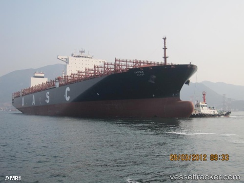
 TAYMA EXPRESS
Current Status
Where is the vessel?
TAYMA EXPRESS is currently in 69 nm S of António Enes, based on AIS data received about 14h ago.
Latest AIS update:
Current position: 17.34019° S, 40.10750° E (69 nm S of António Enes)
Average speed (last 7 days): Loading…
Average speed (last 30 days): Loading…
Vessel profile: TAYMA EXPRESS is a Cargo A with dimensions m x m.
This page combines live AIS, route history, probable destination signals, nearby traffic, and port activity for practical vessel monitoring.
The current position of vessel TAYMA EXPRESS is -17.34019 lat / 40.10750 lng. Updated: 2026-05-18 06:03:38 UTCNearest reference points:
- 95 nm E of Quelimane
Currently sailing under the flag of Liberia ![]()
Details:
Live Vessel TAYMA EXPRESS Analytics (details, animations, etc.)
Recent AIS points (UTC):
2026-05-18 03:55:28 UTC · -17.78942, 39.89782 · SOG 14.8 kn · COG 23°2026-05-18 04:12:52 UTC · -17.72289, 39.92365 · SOG 14.5 kn · COG 22°
2026-05-18 05:01:40 UTC · -17.55162, 40.00183 · SOG 13.2 kn · COG 24°
2026-05-18 06:03:38 UTC · -17.34019, 40.10750 · SOG 13.9 kn · COG 18°