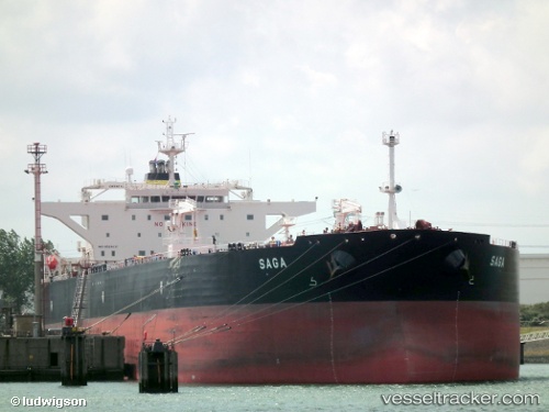
 Saga
Saga
Current Status
Where is the vessel?
Saga is currently in 12 nm SE of Kumport, based on AIS data received about 14h ago.
Latest AIS update:
Current position: 40.77260° N, 28.92679° E (12 nm SE of Kumport)
Average speed (last 7 days): Loading…
Average speed (last 30 days): Loading…
Vessel profile: Saga is a Crude Oil Tanker with dimensions 249m x 44m.
This page combines live AIS, route history, probable destination signals, nearby traffic, and port activity for practical vessel monitoring.
The current position of vessel Saga is 40.77260 lat / 28.92679 lng. Updated: 2026-05-19 13:23:30 UTCNearest reference points:
- 10 nm SE of Kumport
- Near Kumport
- 14 nm SW of Maltepe
Currently sailing under the flag of Malta ![]()
Saga built in 2010 year
Deadweight:
115738 tDetails:
Live Vessel Saga Analytics (details, animations, etc.)
Recent AIS points (UTC):
2026-05-19 10:07:59 UTC · 40.70824, 29.32954 · SOG 7.3 kn · COG 286°2026-05-19 10:10:39 UTC · 40.70958, 29.32204 · SOG 7.8 kn · COG 286°
2026-05-19 12:00:39 UTC · 40.75348, 29.02251 · SOG 8.2 kn · COG 277°
2026-05-19 13:23:30 UTC · 40.77260, 28.92679 · SOG 10.3 kn · COG 40°