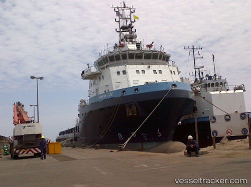
 HANDIN TIDE
Current Status
Where is the vessel?
HANDIN TIDE is currently in 124 nm N of Adventure, based on AIS data received about 16h ago.
Latest AIS update:
Current position: 9.09183° N, 58.93526° W (124 nm N of Adventure)
Average speed (last 7 days): Loading…
Average speed (last 30 days): Loading…
Vessel profile: HANDIN TIDE is a Multi Purpose Offshore Vessel with dimensions m x m.
This page combines live AIS, route history, probable destination signals, nearby traffic, and port activity for practical vessel monitoring.
The current position of vessel HANDIN TIDE is 9.09183 lat / -58.93526 lng. Updated: 2026-05-19 01:27:18 UTCNearest reference points:
- 57 nm NE of Adventure
- 16 nm E of Galeota Point
Currently sailing under the flag of Mexico ![]()
Details:
Live Vessel HANDIN TIDE Analytics (details, animations, etc.)
Recent AIS points (UTC):
2026-05-18 22:31:56 UTC · 9.39667, -59.21500 · SOG 8 kn · COG -1°2026-05-18 23:49:40 UTC · 9.26675, -59.09036 · SOG 8.6 kn · COG 130°
2026-05-19 01:08:00 UTC · 9.12667, -58.96500 · SOG 8 kn · COG -1°
2026-05-19 01:27:18 UTC · 9.09183, -58.93526 · SOG 8.6 kn · COG 131°