 vesseltracker.com
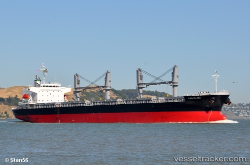
 KING ISLAND
Current Status
Where is the vessel?
KING ISLAND is currently in 14 nm W of Bayovar, based on AIS data received about 14h ago.
Latest AIS update:
Current position: 5.81369° S, 81.29989° W (14 nm W of Bayovar)
Average speed (last 7 days): Loading…
Average speed (last 30 days): Loading…
Vessel profile: KING ISLAND is a General Cargo with dimensions m x m.
This page combines live AIS, route history, probable destination signals, nearby traffic, and port activity for practical vessel monitoring.
The current position of vessel KING ISLAND is -5.81369 lat / -81.29989 lng. Updated: 2026-05-18 11:09:27 UTCNearest reference points:
- Near PAITA
- 75 nm SW of Talara
Currently sailing under the flag of Panama ![]()
Details:
Live Vessel KING ISLAND Analytics (details, animations, etc.)
Recent AIS points (UTC):
2026-05-18 07:00:00 UTC · -6.28888, -81.33409 · SOG 6.4 kn · COG 349°2026-05-18 08:18:32 UTC · -6.14964, -81.35079 · SOG 6.3 kn · COG 347°
2026-05-18 09:56:48 UTC · -5.96500, -81.34500 · SOG 7 kn · COG -1°
2026-05-18 11:09:27 UTC · -5.81369, -81.29989 · SOG 7.7 kn · COG 22°