 JOHNY
JOHNY
Current Status
Where is the vessel?
JOHNY is currently in 117 nm E of Ryuo, based on AIS data received about 14h ago.
Latest AIS update:
Current position: 36.19615° N, 18.93675° E (117 nm E of Ryuo)
Average speed (last 7 days): Loading…
Average speed (last 30 days): Loading…
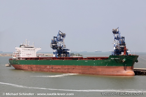
Vessel profile: JOHNY is a Bulk Carrier with dimensions m x m.
This page combines live AIS, route history, probable destination signals, nearby traffic, and port activity for practical vessel monitoring.
The current position of vessel JOHNY is 36.19615 lat / 18.93675 lng. Updated: 2026-05-22 06:49:27 UTCNearest reference points:
- 103 nm NE of Ryuo
- 73 nm N of Pinelands
- 71 nm N of Pinelands
Currently sailing under the flag of Marshall Islands ![]()
Details:
Live Vessel JOHNY Analytics (details, animations, etc.)
Recent AIS points (UTC):
2026-05-22 03:59:07 UTC · 36.22333, 18.21833 · SOG 11 kn · COG -1°2026-05-22 03:59:07 UTC · 36.22333, 18.21833 · SOG 11 kn · COG -1°
2026-05-22 05:42:17 UTC · 36.20169, 18.64838 · SOG 12.8 kn · COG 89°
2026-05-22 06:49:27 UTC · 36.19615, 18.93675 · SOG 11.4 kn · COG 89°