 ANGIE
ANGIE
Current Status
Where is the vessel?
ANGIE is currently in 32 nm E of Ceuta, based on AIS data received about 14h ago.
Latest AIS update:
Current position: 35.94677° N, 4.66123° W (32 nm E of Ceuta)
Average speed (last 7 days): Loading…
Average speed (last 30 days): Loading…
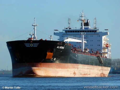
Vessel profile: ANGIE is a Oil/Chemical Tanker with dimensions m x m.
This page combines live AIS, route history, probable destination signals, nearby traffic, and port activity for practical vessel monitoring.
The current position of vessel ANGIE is 35.94677 lat / -4.66123 lng. Updated: 2026-05-18 17:58:22 UTCNearest reference points:
- 30 nm E of Ceuta
- 31 nm SE of Fuengirola
- Near Fuengirola
Currently sailing under the flag of Liberia ![]()
Details:
Live Vessel ANGIE Analytics (details, animations, etc.)
Recent AIS points (UTC):
2026-05-18 14:01:42 UTC · 35.90029, -4.78179 · SOG 1.7 kn · COG 351°2026-05-18 16:22:13 UTC · 35.93253, -4.70928 · SOG 1.7 kn · COG 351°
2026-05-18 16:25:53 UTC · 35.93319, -4.70716 · SOG 1.7 kn · COG 349°
2026-05-18 17:58:22 UTC · 35.94677, -4.66123 · SOG 3.4 kn · COG 223°