 vesseltracker.com
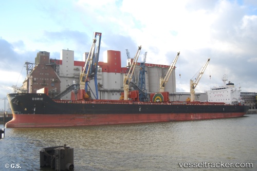
 ANTIGONI FORCE
Current Status
Where is the vessel?
ANTIGONI FORCE is currently in 22 nm W of Bataduwa, based on AIS data received about 14h ago.
Latest AIS update:
Current position: 6.10042° N, 79.74939° E (22 nm W of Bataduwa)
Average speed (last 7 days): Loading…
Average speed (last 30 days): Loading…
Vessel profile: ANTIGONI FORCE is a Bulk Carrier with dimensions 32m x 196m.
This page combines live AIS, route history, probable destination signals, nearby traffic, and port activity for practical vessel monitoring.
The current position of vessel ANTIGONI FORCE is 6.10042 lat / 79.74939 lng. Updated: 2026-05-17 19:35:25 UTCNearest reference points:
- 19 nm SW of Bataduwa
- 38 nm SW of Galle
- 15 nm S of Koggala
Currently sailing under the flag of Marshall Islands ![]()
ANTIGONI FORCE built in 2013 year
Deadweight:
58514 tDetails:
Live Vessel ANTIGONI FORCE Analytics (details, animations, etc.)
Recent AIS points (UTC):
2026-05-17 16:58:46 UTC · 6.33182, 79.40733 · SOG 9.3 kn · COG 125°2026-05-17 18:14:16 UTC · 6.22421, 79.57429 · SOG 9.3 kn · COG 123°
2026-05-17 19:19:25 UTC · 6.12680, 79.71571 · SOG 9.5 kn · COG 127°
2026-05-17 19:35:25 UTC · 6.10042, 79.74939 · SOG 9.7 kn · COG 131°