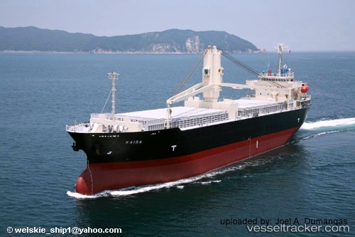
 KAISA
KAISA
Current Status
Where is the vessel?
KAISA is currently in 48 nm NW of Balabac, Palawan, based on AIS data received about 15h ago.
Latest AIS update:
Current position: 8.41167° N, 116.38500° E (48 nm NW of Balabac, Palawan)
Average speed (last 7 days): Loading…
Average speed (last 30 days): Loading…
Vessel profile: KAISA is a General Cargo with dimensions m x m.
This page combines live AIS, route history, probable destination signals, nearby traffic, and port activity for practical vessel monitoring.
The current position of vessel KAISA is 8.41167 lat / 116.38500 lng. Updated: 2026-05-20 22:09:06 UTCNearest reference points:
- 35 nm SE of Brookes Point, Palawan
- 70 nm W of Puerto Princesa
- Near Kota Kinabalu
Currently sailing under the flag of Panama ![]()
Details:
Live Vessel KAISA Analytics (details, animations, etc.)
Recent AIS points (UTC):
2026-05-20 17:33:06 UTC · 7.75500, 115.80333 · SOG 11 kn · COG -1°2026-05-20 19:12:04 UTC · 7.99167, 116.01333 · SOG 11 kn · COG -1°
2026-05-20 21:42:05 UTC · 8.34666, 116.32833 · SOG 11 kn · COG -1°
2026-05-20 22:09:06 UTC · 8.41167, 116.38500 · SOG 11 kn · COG -1°