 MAREM
MAREM
Current Status
Where is the vessel?
MAREM is currently in Near Santos, based on AIS data received about 14h ago.
Latest AIS update:
Current position: 23.94929° S, 46.31159° W (Near Santos)
Average speed (last 7 days): Loading…
Average speed (last 30 days): Loading…
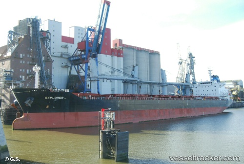
Vessel profile: MAREM is a Bulk Carrier with dimensions 30m x 180m.
This page combines live AIS, route history, probable destination signals, nearby traffic, and port activity for practical vessel monitoring.
The current position of vessel MAREM is -23.94929 lat / -46.31159 lng. Updated: 2026-05-20 02:11:45 UTCNearest reference points:
- Near Guarujá
- Near Santos
- 30 nm SE of Guarujá
Currently sailing under the flag of Marshall Islands ![]()
MAREM built in 2012 year
Deadweight:
34148 tDetails:
Live Vessel MAREM Analytics (details, animations, etc.)
Recent AIS points (UTC):
2026-05-19 22:56:45 UTC · -23.94928, -46.31157 · SOG 0 kn · COG 351°2026-05-19 23:50:42 UTC · -23.94937, -46.31156 · SOG 0 kn · COG 350°
2026-05-20 01:53:45 UTC · -23.94932, -46.31159 · SOG 0 kn · COG 351°
2026-05-20 02:11:45 UTC · -23.94929, -46.31159 · SOG 0 kn · COG 351°