 GEOQUIP SPEER
Current Status
Where is the vessel?
GEOQUIP SPEER is currently in Near S GRAVENDEEL, based on AIS data received about 14h ago.
Latest AIS update:
Current position: 51.79397° N, 4.61843° E (Near S GRAVENDEEL)
Average speed (last 7 days): Loading…
Average speed (last 30 days): Loading…
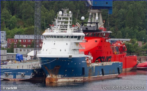
Vessel profile: GEOQUIP SPEER is a Offshore Supply Ship with dimensions m x m.
This page combines live AIS, route history, probable destination signals, nearby traffic, and port activity for practical vessel monitoring.
The current position of vessel GEOQUIP SPEER is 51.79397 lat / 4.61843 lng. Updated: 2026-05-22 08:13:58 UTCNearest reference points:
- Near Mookhoek
- Near STRIJENSAS
- Near Puttershoek
Currently sailing under the flag of Cyprus ![]()
Details:
Live Vessel GEOQUIP SPEER Analytics (details, animations, etc.)
Recent AIS points (UTC):
2026-05-22 04:23:00 UTC · 51.79398, 4.61844 · SOG 0 kn · COG 201°2026-05-22 05:59:10 UTC · 51.79397, 4.61844 · SOG 0 kn · COG 200°
2026-05-22 07:07:56 UTC · 51.79398, 4.61844 · SOG 0 kn · COG 200°
2026-05-22 08:13:58 UTC · 51.79397, 4.61843 · SOG 0 kn · COG 200°