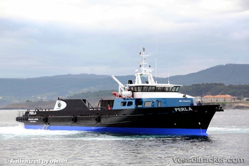
Perla
Current StatusWhere is the vessel?
Perla is currently in 12 nm SE of Cantarell, based on AIS data received about 13d ago.
Latest AIS update:
Current position: 19.50655° N, 91.96926° W (12 nm SE of Cantarell)
Average speed (last 7 days): Loading…
Average speed (last 30 days): Loading…
Vessel profile: Perla is a Offshore Tug Supply Ship with dimensions 10m x 53m.
This page combines live AIS, route history, probable destination signals, nearby traffic, and port activity for practical vessel monitoring.
The current position of vessel Perla is 19.50655 lat / -91.96926 lng. Updated: 2026-05-05 21:42:41 UTCNearest reference points:
- Near Yùum K'Ak'Náab
- 18 nm S of Yùum K'Ak'Náab
- 35 nm S of Yùum K'Ak'Náab
Details:
Live Vessel Perla Analytics (details, animations, etc.)
Recent AIS points (UTC):
2026-05-05 21:42:41 UTC · 19.50655, -91.96926 · SOG 0 kn · COG 197°2026-05-05 21:42:41 UTC · 19.50655, -91.96926 · SOG 0 kn · COG 197°
2026-05-05 21:42:41 UTC · 19.50655, -91.96926 · SOG 0 kn · COG 197°
2026-05-05 21:42:41 UTC · 19.50655, -91.96926 · SOG 0 kn · COG 197°