 Longvind
Current Status
Where is the vessel?
Longvind is currently in Near AVEDORE, based on AIS data received about 14h ago.
Latest AIS update:
Current position: 55.60083° N, 12.48323° E (Near AVEDORE)
Average speed (last 7 days): Loading…
Average speed (last 30 days): Loading…
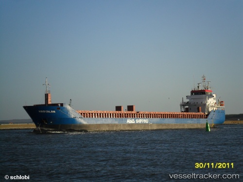
Vessel profile: Longvind is a General Cargo Ship with dimensions 115m x 15m.
This page combines live AIS, route history, probable destination signals, nearby traffic, and port activity for practical vessel monitoring.
The current position of vessel Longvind is 55.60083 lat / 12.48323 lng. Updated: 2026-05-18 20:21:43 UTCNearest reference points:
- Near Brondby Strand
- Near Skanör
- Near Rungsted
Currently sailing under the flag of Netherlands ![]()
Longvind built in 2011 year
Deadweight:
6050 tDetails:
Live Vessel Longvind Analytics (details, animations, etc.)
Recent AIS points (UTC):
2026-05-18 16:36:41 UTC · 55.60090, 12.48322 · SOG 0 kn · COG 97°2026-05-18 17:30:39 UTC · 55.60083, 12.48320 · SOG 0 kn · COG 97°
2026-05-18 19:12:39 UTC · 55.60085, 12.48317 · SOG 0 kn · COG 97°
2026-05-18 20:21:43 UTC · 55.60083, 12.48323 · SOG 0 kn · COG 97°