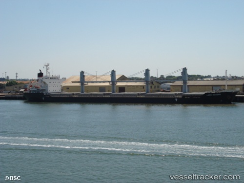
 LADY AILLAR
Current Status
Where is the vessel?
LADY AILLAR is currently in Near Luanda, based on AIS data received about 14h ago.
Latest AIS update:
Current position: 8.79592° S, 13.24671° E (Near Luanda)
Average speed (last 7 days): Loading…
Average speed (last 30 days): Loading…
Vessel profile: LADY AILLAR is a Bulk Carrier with dimensions m x m.
This page combines live AIS, route history, probable destination signals, nearby traffic, and port activity for practical vessel monitoring.
The current position of vessel LADY AILLAR is -8.79592 lat / 13.24671 lng. Updated: 2026-05-22 09:25:16 UTCNearest reference points:
- Near Luanda
- Near Greater Plutonio
Currently sailing under the flag of Barbados ![]()
Details:
Live Vessel LADY AILLAR Analytics (details, animations, etc.)
Recent AIS points (UTC):
2026-05-22 05:55:21 UTC · -8.79587, 13.24679 · SOG 0 kn · COG 298°2026-05-22 07:10:17 UTC · -8.79589, 13.24677 · SOG 0 kn · COG 299°
2026-05-22 08:16:15 UTC · -8.79584, 13.24678 · SOG 0 kn · COG 299°
2026-05-22 09:25:16 UTC · -8.79592, 13.24671 · SOG 0 kn · COG 298°