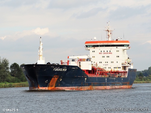
 FURUHOLMEN
Current Status
Where is the vessel?
FURUHOLMEN is currently in 40 nm SE of Matagorda Bay, based on AIS data received about 15h ago.
Latest AIS update:
Current position: 27.84160° N, 95.86566° W (40 nm SE of Matagorda Bay)
Average speed (last 7 days): Loading…
Average speed (last 30 days): Loading…
Vessel profile: FURUHOLMEN is a Oil/Chemical Tanker with dimensions m x m.
This page combines live AIS, route history, probable destination signals, nearby traffic, and port activity for practical vessel monitoring.
The current position of vessel FURUHOLMEN is 27.84160 lat / -95.86566 lng. Updated: 2026-05-18 17:16:52 UTCNearest reference points:
- Near Matagorda Bay
- 14 nm E of PALACIOS
- 10 nm E of Port Aransas
Currently sailing under the flag of Portugal ![]()
Details:
Live Vessel FURUHOLMEN Analytics (details, animations, etc.)
Recent AIS points (UTC):
2026-05-18 13:38:53 UTC · 27.74661, -96.41130 · SOG 0.2 kn · COG 133°2026-05-18 16:12:59 UTC · 27.77693, -96.06266 · SOG 10.5 kn · COG 93°
2026-05-18 16:19:11 UTC · 27.77753, -96.04506 · SOG 10.5 kn · COG -1°
2026-05-18 17:16:52 UTC · 27.84160, -95.86566 · SOG 11.3 kn · COG -1°