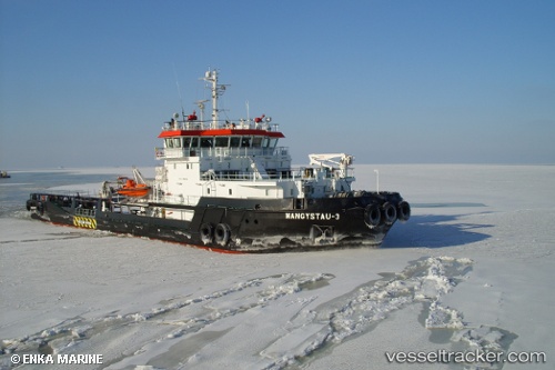
Mangystau 3
Current StatusWhere is the vessel?
Mangystau 3 is currently in 36 nm SW of Krasnovodsk, based on AIS data received about 14h ago.
Latest AIS update:
Current position: 39.69821° N, 52.30078° E (36 nm SW of Krasnovodsk)
Average speed (last 7 days): Loading…
Average speed (last 30 days): Loading…
Vessel profile: Mangystau 3 is a [tug.offshore_tug_supply] with dimensions 16m x 66m.
This page combines live AIS, route history, probable destination signals, nearby traffic, and port activity for practical vessel monitoring.
The current position of vessel Mangystau 3 is 39.69821 lat / 52.30078 lng. Updated: 2026-05-18 17:35:27 UTCNearest reference points:
- 42 nm W of Hazar
- Near Hazar
- Near Krasnovodsk
Details:
Live Vessel Mangystau 3 Analytics (details, animations, etc.)
Recent AIS points (UTC):
2026-05-18 13:58:44 UTC · 39.69829, 52.30163 · SOG 0.2 kn · COG 330°2026-05-18 15:31:45 UTC · 39.69835, 52.30050 · SOG 0.3 kn · COG 3°
2026-05-18 17:02:27 UTC · 39.69822, 52.30074 · SOG 0.2 kn · COG 2°
2026-05-18 17:35:27 UTC · 39.69821, 52.30078 · SOG 0.1 kn · COG 346°