 AS NORA
Current Status
Where is the vessel?
AS NORA is currently in 12 nm SE of Offshore Fujairah, based on AIS data received about 2d ago.
Latest AIS update:
Current position: 25.06809° N, 56.76728° E (12 nm SE of Offshore Fujairah)
Average speed (last 7 days): Loading…
Average speed (last 30 days): Loading…
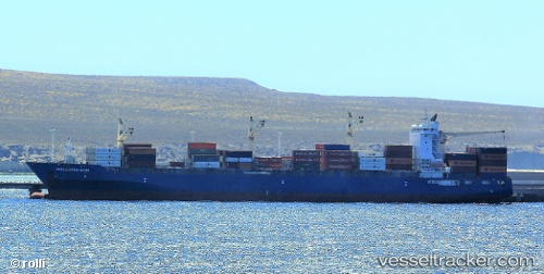
Vessel profile: AS NORA is a Cargo A with dimensions m x m.
This page combines live AIS, route history, probable destination signals, nearby traffic, and port activity for practical vessel monitoring.
The current position of vessel AS NORA is 25.06809 lat / 56.76728 lng. Updated: 2026-05-17 03:20:24 UTCNearest reference points:
- Near Offshore Fujairah
- Near Fujairah
- Near KHORFAKKAN
Currently sailing under the flag of Marshall Islands ![]()
Details:
Live Vessel AS NORA Analytics (details, animations, etc.)
Recent AIS points (UTC):
2026-05-17 03:20:24 UTC · 25.06809, 56.76728 · SOG 6.1 kn · COG 310°2026-05-17 03:20:24 UTC · 25.06809, 56.76728 · SOG 6.1 kn · COG 310°
2026-05-17 03:20:24 UTC · 25.06809, 56.76728 · SOG 6.1 kn · COG 310°
2026-05-17 03:20:24 UTC · 25.06809, 56.76728 · SOG 6.1 kn · COG 310°