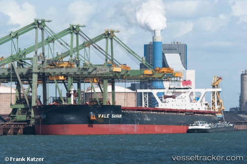
Saham Max
Current StatusWhere is the vessel?
Saham Max is currently in 312 nm SW of Calang, based on AIS data received about 14h ago.
Latest AIS update:
Current position: 2.45053° N, 90.85737° E (312 nm SW of Calang)
Average speed (last 7 days): Loading…
Average speed (last 30 days): Loading…
Vessel profile: Saham Max is a Ore Carrier with dimensions 65m x 360m.
This page combines live AIS, route history, probable destination signals, nearby traffic, and port activity for practical vessel monitoring.
The current position of vessel Saham Max is 2.45053 lat / 90.85737 lng. Updated: 2026-05-19 15:21:17 UTCNearest reference points:
- Open sea, approx. 401 nm off the nearest listed port
- Open sea, approx. 403 nm off the nearest listed port
- Open sea, approx. 408 nm off the nearest listed port
Details:
Live Vessel Saham Max Analytics (details, animations, etc.)
Recent AIS points (UTC):
2026-05-19 11:49:54 UTC · 3.02654, 91.43315 · SOG 13.9 kn · COG 224°2026-05-19 13:16:32 UTC · 2.78833, 91.19333 · SOG 13 kn · COG -1°
2026-05-19 13:26:56 UTC · 2.75924, 91.16576 · SOG 14 kn · COG 224°
2026-05-19 15:21:17 UTC · 2.45053, 90.85737 · SOG 13.8 kn · COG -1°