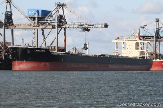
Linda Hope
Current StatusWhere is the vessel?
Linda Hope is currently in 214 nm W of Cocos Islands, based on AIS data received about 14h ago.
Latest AIS update:
Current position: 12.46916° S, 93.22193° E (214 nm W of Cocos Islands)
Average speed (last 7 days): Loading…
Average speed (last 30 days): Loading…
Vessel profile: Linda Hope is a Bulk Carrier with dimensions 45m x 292m.
This page combines live AIS, route history, probable destination signals, nearby traffic, and port activity for practical vessel monitoring.
The current position of vessel Linda Hope is -12.46916 lat / 93.22193 lng. Updated: 2026-05-21 16:31:41 UTCDetails:
Live Vessel Linda Hope Analytics (details, animations, etc.)
Recent AIS points (UTC):
2026-05-21 13:56:09 UTC · -12.66869, 92.80809 · SOG 10.1 kn · COG 64°2026-05-21 13:57:59 UTC · -12.66652, 92.81245 · SOG 10.3 kn · COG 64°
2026-05-21 16:03:51 UTC · -12.50407, 93.14555 · SOG 10.5 kn · COG 64°
2026-05-21 16:31:41 UTC · -12.46916, 93.22193 · SOG 10.8 kn · COG 64°