 EASTERN MAGNOLIA
Current Status
Where is the vessel?
EASTERN MAGNOLIA is currently in 14 nm SW of Cape St. Francis, based on AIS data received about 14h ago.
Latest AIS update:
Current position: 34.34020° S, 24.62653° E (14 nm SW of Cape St. Francis)
Average speed (last 7 days): Loading…
Average speed (last 30 days): Loading…
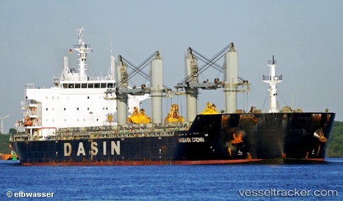
Vessel profile: EASTERN MAGNOLIA is a Bulk Carrier with dimensions 190m x 189m.
This page combines live AIS, route history, probable destination signals, nearby traffic, and port activity for practical vessel monitoring.
The current position of vessel EASTERN MAGNOLIA is -34.34020 lat / 24.62653 lng. Updated: 2026-05-19 14:22:22 UTCNearest reference points:
- 21 nm S of Mount Pleasant
- Near Deal Party
- Near Mosselbaai
Currently sailing under the flag of Liberia ![]()
EASTERN MAGNOLIA built in 2012 year
Deadweight:
56406 tDetails:
Live Vessel EASTERN MAGNOLIA Analytics (details, animations, etc.)
Recent AIS points (UTC):
2026-05-19 10:09:51 UTC · -34.47730, 23.84618 · SOG 9.3 kn · COG 85°2026-05-19 11:59:24 UTC · -34.42967, 24.18271 · SOG 9.5 kn · COG 78°
2026-05-19 13:20:13 UTC · -34.37537, 24.43316 · SOG 9.7 kn · COG 76°
2026-05-19 14:22:22 UTC · -34.34020, 24.62653 · SOG 8.8 kn · COG 85°