.

LB flag HELLASSHIP

Vessel type: Bulk Carrier | IMO: 9574236 | MMSI: MMSI: 636020735
Call sign: 5LAL4 | Dimensions: 292 m x 45 m
Current Status

Where is the vessel?

HELLASSHIP is currently in 26 nm E of Kakap Natuna Terminal, based on AIS data received about 14h ago.

Latest AIS update:

Current position: 4.89006° N, 106.37093° E (26 nm E of Kakap Natuna Terminal)

Average speed (last 7 days): Loading…

Average speed (last 30 days): Loading…

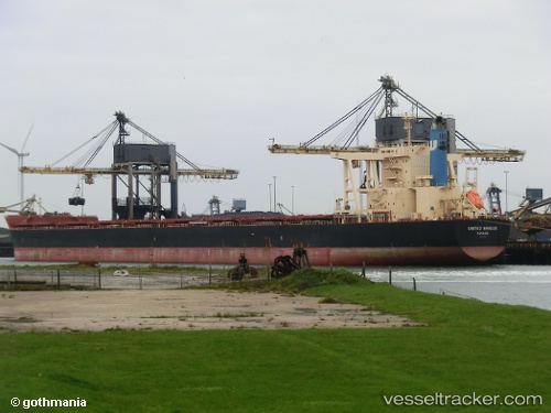
Vessel profile: HELLASSHIP is a Bulk Carrier with dimensions 292m x 45m.

This page combines live AIS, route history, probable destination signals, nearby traffic, and port activity for practical vessel monitoring.

The current position of vessel HELLASSHIP is 4.89006 lat / 106.37093 lng. Updated: 2026-05-19 19:18:38 UTC
More recent position available: 3 min ago
Free positions are delayed by 14 hours.

We recommend registering. If you register, paid vessel access will be saved in your profile. Guest access works only through a personal link.

Nearest reference points:
  • 45 nm E of Kakap Natuna Terminal
  • 46 nm E of Kakap Natuna Terminal
  • 36 nm SW of Slipi

Currently sailing under the flag of Liberia LB flag

HELLASSHIP built in 2012 year

Deadweight:
181325 t

Details:

Live Vessel HELLASSHIP Analytics (details, animations, etc.)


Recent AIS points (UTC):
2026-05-19 15:27:40 UTC · 5.42029, 106.74988 · SOG 10.1 kn · COG -1°
2026-05-19 16:42:47 UTC · 5.26172, 106.61012 · SOG 10.3 kn · COG -1°
2026-05-19 18:08:51 UTC · 5.05882, 106.47956 · SOG 10.2 kn · COG 212°
2026-05-19 19:18:38 UTC · 4.89006, 106.37093 · SOG 10.1 kn · COG -1°

UTC: --
Start: -- Track timeline (UTC) End: --
Encountered: --


Link to the map:


Find another ship

HELLASSHIP (636020735) last ports (portcalls and passsages)

Singapore | 2025-08-30 21:38:53
PULAU SAMBU | 2025-08-30 21:23:26
TANAH MERAH | 2025-08-30 07:33:25
PENGERANG | 2025-08-30 06:22:02
Map Ta Phut | 2025-08-23 11:19:35
Newcastle | 2025-08-06 00:17:01
Newcastle | 2025-08-01 23:58:42
CAOFEIDIAN | 2025-07-09 22:43:43
Selat Lombok | 2025-06-24 11:46:01
PORT WALCOTT | 2025-06-20 19:47:37
Selat Lombok | 2025-06-10 13:02:15
Map Ta Phut | 2025-05-30 14:59:11
Zamboanga | 2025-05-23 03:31:18
Newcastle | 2025-05-09 01:36:26
PENGERANG | 2025-03-27 18:13:28
TANAH MERAH | 2025-03-27 02:17:30
BATU AMPAR | 2025-03-27 00:32:27
PULAU SAMBU | 2025-03-26 23:51:42
PULAU SAMBU | 2025-01-13 08:25:57
BATU AMPAR | 2025-01-13 07:49:08
TANAH MERAH | 2025-01-12 21:46:30
PENGERANG | 2025-01-12 20:21:56
ZHUHAI | 2025-01-05 08:21:34
PENGERANG | 2024-12-27 15:13:49
TANAH MERAH | 2024-12-27 01:21:12
PULAU SAMBU | 2024-12-26 23:26:18
Narvik | 2024-11-08 13:15:36
Narvik | 2024-11-04 13:06:23
Narvik | 2024-10-31 12:52:24
Strait Of Gibraltar | 2024-09-02 22:39:31
Algeciras | 2024-09-01 19:27:33
Strait Of Gibraltar | 2024-08-11 09:24:01
Tubarao | 2024-07-26 22:15:21
Singapore | 2024-05-30 16:47:23
Sambu | 2024-05-30 16:40:42
Muroran | 2024-04-26 10:00:34
Oita | 2024-04-21 08:08:12
Port Headland | 2024-04-05 03:34:40
Higashi-Iwase | 2024-03-11 21:25:54
Oita | 2024-03-08 10:47:44
Newcastle | 2024-02-16 23:24:07
Nagoya | 2024-01-29 00:58:16
Honshu | 2024-01-28 00:58:24
Kamaishi | 2024-01-23 05:58:23
Honshu | 2024-01-19 12:58:15
Yokohama | 2024-01-19 04:58:50
Yokosuka | 2024-01-13 04:36:04
Honshu | 2024-01-12 17:59:13
Singapore | 2023-11-12 11:53:18
Newcastle | 2023-07-23 23:32:45
Sambu | 2023-06-11 23:02:05
Sebang | 2023-06-09 09:03:29
Sept Iles | 2023-04-20 02:02:45
Cristobal | 2023-03-14 20:46:24
Balboa | 2023-03-14 08:50:40
Panama | 2023-03-11 14:28:25
Victoria | 2023-02-23 02:49:28
Victoria | 2023-02-18 17:45:38
Rizhao | 2023-01-26 02:04:22
Sambu | 2023-01-09 02:20:09