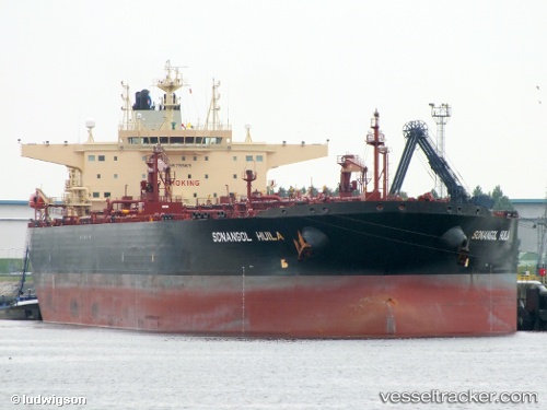
 Sonangol Huila
Current Status
Where is the vessel?
Sonangol Huila is currently in 134 nm NW of Henties Bay (Hentiesbaai), based on AIS data received about 14h ago.
Latest AIS update:
Current position: 20.79995° S, 12.33680° E (134 nm NW of Henties Bay (Hentiesbaai))
Average speed (last 7 days): Loading…
Average speed (last 30 days): Loading…
Vessel profile: Sonangol Huila is a Crude Oil Tanker with dimensions 273m x 48m.
This page combines live AIS, route history, probable destination signals, nearby traffic, and port activity for practical vessel monitoring.
The current position of vessel Sonangol Huila is -20.79995 lat / 12.33680 lng. Updated: 2026-05-19 19:26:54 UTCNearest reference points:
- 136 nm S of Baía dos Tigres
- 151 nm W of Henties Bay (Hentiesbaai)
- Near WALVIS BAY
Currently sailing under the flag of Bahamas ![]()
Sonangol Huila built in 2012 year
Deadweight:
157871 tDetails:
Live Vessel Sonangol Huila Analytics (details, animations, etc.)
Recent AIS points (UTC):
2026-05-19 16:18:26 UTC · -21.38683, 12.53879 · SOG 12.3 kn · COG 343°2026-05-19 17:23:42 UTC · -21.18333, 12.46833 · SOG 12 kn · COG -1°
2026-05-19 19:26:54 UTC · -20.79995, 12.33680 · SOG 11.8 kn · COG 344°
2026-05-19 19:26:54 UTC · -20.79995, 12.33680 · SOG 11.8 kn · COG 344°