 AM POWER
Current Status
Where is the vessel?
AM POWER is currently in 72 nm S of Jafarabad, based on AIS data received about 14h ago.
Latest AIS update:
Current position: 19.65833° N, 71.29167° E (72 nm S of Jafarabad)
Average speed (last 7 days): Loading…
Average speed (last 30 days): Loading…
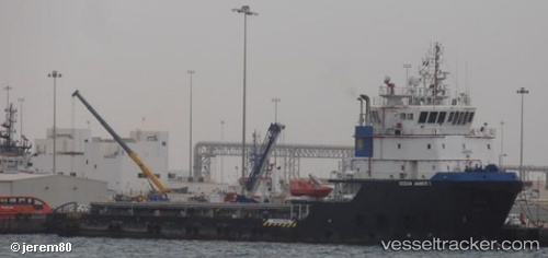
Vessel profile: AM POWER is a Other Type with dimensions m x m.
This page combines live AIS, route history, probable destination signals, nearby traffic, and port activity for practical vessel monitoring.
The current position of vessel AM POWER is 19.65833 lat / 71.29167 lng. Updated: 2026-05-22 09:38:27 UTCNearest reference points:
- 33 nm S of Mul Dwårka
- Near Jafarabad
- 17 nm SE of Port Pipavav
Currently sailing under the flag of Marshall Islands ![]()
Details:
Live Vessel AM POWER Analytics (details, animations, etc.)
Recent AIS points (UTC):
2026-05-22 05:27:45 UTC · 19.59021, 71.38470 · SOG 0.5 kn · COG -1°2026-05-22 07:26:20 UTC · 19.64167, 71.30833 · SOG 3 kn · COG -1°
2026-05-22 08:05:20 UTC · 19.64833, 71.30167 · SOG 1 kn · COG -1°
2026-05-22 09:38:27 UTC · 19.65833, 71.29167 · SOG 0 kn · COG -1°