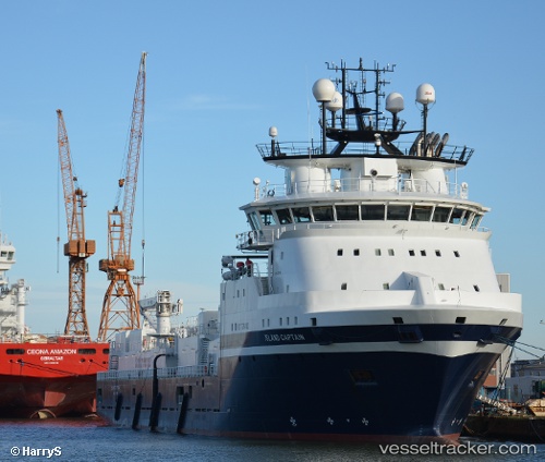
 Island Captain
Current Status
Where is the vessel?
Island Captain is currently in 11 nm NE of South Arne, based on AIS data received about 15h ago.
Latest AIS update:
Current position: 56.23500° N, 4.40833° E (11 nm NE of South Arne)
Average speed (last 7 days): Loading…
Average speed (last 30 days): Loading…
Vessel profile: Island Captain is a Well Stimulation Vessel with dimensions 93m x 93m.
This page combines live AIS, route history, probable destination signals, nearby traffic, and port activity for practical vessel monitoring.
The current position of vessel Island Captain is 56.23500 lat / 4.40833 lng. Updated: 2026-05-18 20:20:52 UTCNearest reference points:
- 26 nm W of Cleghorn
- Near Egersund
- 19 nm NW of Neeltje Jans
Currently sailing under the flag of Norway ![]()
Island Captain built in 2012 year
Deadweight:
4500 tDetails:
Live Vessel Island Captain Analytics (details, animations, etc.)
Recent AIS points (UTC):
2026-05-18 11:31:57 UTC · 56.42457, 3.21015 · SOG 0.1 kn · COG -1°2026-05-18 17:32:52 UTC · 56.40500, 3.43167 · SOG 12 kn · COG -1°
2026-05-18 19:02:50 UTC · 56.33333, 3.96833 · SOG 12 kn · COG -1°
2026-05-18 20:20:52 UTC · 56.23500, 4.40833 · SOG 12 kn · COG -1°