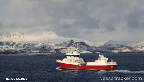
 OCEAN PROSPER
Current Status
Where is the vessel?
OCEAN PROSPER is currently in Near Pennygown, based on AIS data received about 15h ago.
Latest AIS update:
Current position: 56.55947° N, 5.92159° W (Near Pennygown)
Average speed (last 7 days): Loading…
Average speed (last 30 days): Loading…
Vessel profile: OCEAN PROSPER is a Fish Carrier with dimensions m x m.
This page combines live AIS, route history, probable destination signals, nearby traffic, and port activity for practical vessel monitoring.
The current position of vessel OCEAN PROSPER is 56.55947 lat / -5.92159 lng. Updated: 2026-05-19 01:32:31 UTCNearest reference points:
- Near Fishnish, Isle of Mull
- Near CRAIGNURE PIER
- Near OBAN
Currently sailing under the flag of United Kingdom ![]()
Details:
Live Vessel OCEAN PROSPER Analytics (details, animations, etc.)
Recent AIS points (UTC):
2026-05-18 23:10:42 UTC · 56.55213, -5.92744 · SOG 2.2 kn · COG 321°2026-05-18 23:59:27 UTC · 56.55944, -5.92150 · SOG 0.1 kn · COG 144°
2026-05-19 01:29:52 UTC · 56.55947, -5.92159 · SOG 0 kn · COG 111°
2026-05-19 01:32:31 UTC · 56.55947, -5.92159 · SOG 0 kn · COG 110°