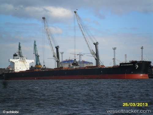
 CARAVOS EXPLORER II
Current Status
Where is the vessel?
CARAVOS EXPLORER II is currently in 79 nm NE of Dinapigue, based on AIS data received about 15h ago.
Latest AIS update:
Current position: 17.44333° N, 123.45500° E (79 nm NE of Dinapigue)
Average speed (last 7 days): Loading…
Average speed (last 30 days): Loading…
Vessel profile: CARAVOS EXPLORER II is a Bulk Carrier with dimensions m x m.
This page combines live AIS, route history, probable destination signals, nearby traffic, and port activity for practical vessel monitoring.
The current position of vessel CARAVOS EXPLORER II is 17.44333 lat / 123.45500 lng. Updated: 2026-05-20 05:32:48 UTCNearest reference points:
- 55 nm SE of Port Irene
- 88 nm E of Port Irene
Currently sailing under the flag of Marshall Islands ![]()
Details:
Live Vessel CARAVOS EXPLORER II Analytics (details, animations, etc.)
Recent AIS points (UTC):
2026-05-20 01:41:50 UTC · 16.94333, 123.96833 · SOG 10 kn · COG -1°2026-05-20 03:26:53 UTC · 17.16333, 123.74167 · SOG 10 kn · COG -1°
2026-05-20 04:08:51 UTC · 17.25667, 123.65167 · SOG 10 kn · COG -1°
2026-05-20 05:32:48 UTC · 17.44333, 123.45500 · SOG 11 kn · COG -1°