 XIN HAI TONG 26
Current Status
Where is the vessel?
XIN HAI TONG 26 is currently in 296 nm NE of Parham, based on AIS data received about 14h ago.
Latest AIS update:
Current position: 19.82162° N, 57.42888° W (296 nm NE of Parham)
Average speed (last 7 days): Loading…
Average speed (last 30 days): Loading…
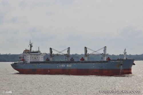
Vessel profile: XIN HAI TONG 26 is a Bulk Carrier with dimensions 189m x 190m.
This page combines live AIS, route history, probable destination signals, nearby traffic, and port activity for practical vessel monitoring.
The current position of vessel XIN HAI TONG 26 is 19.82162 lat / -57.42888 lng. Updated: 2026-05-21 17:21:43 UTCNearest reference points:
- 314 nm NE of La Désirade
- 344 nm S of Luque
Currently sailing under the flag of China Peopless Republic ![]()
XIN HAI TONG 26 built in 2011 year
Deadweight:
56811 tDetails:
Live Vessel XIN HAI TONG 26 Analytics (details, animations, etc.)
Recent AIS points (UTC):
2026-05-21 13:58:32 UTC · 19.50955, -57.94533 · SOG 10.4 kn · COG 58°2026-05-21 15:43:52 UTC · 19.67171, -57.67443 · SOG 10.2 kn · COG 56°
2026-05-21 16:26:42 UTC · 19.73692, -57.56505 · SOG 10.2 kn · COG 56°
2026-05-21 17:21:43 UTC · 19.82162, -57.42888 · SOG 10 kn · COG 57°