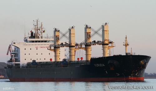
 Veruda
Current Status
Where is the vessel?
Veruda is currently in 115 nm SW of Port de Boké, based on AIS data received about 15h ago.
Latest AIS update:
Current position: 9.03017° N, 15.95517° W (115 nm SW of Port de Boké)
Average speed (last 7 days): Loading…
Average speed (last 30 days): Loading…
Vessel profile: Veruda is a Bulk Carrier with dimensions 182m x 32m.
This page combines live AIS, route history, probable destination signals, nearby traffic, and port activity for practical vessel monitoring.
The current position of vessel Veruda is 9.03017 lat / -15.95517 lng. Updated: 2026-05-22 08:01:59 UTCNearest reference points:
- 97 nm SW of Port de Boké
- 79 nm SW of Conakry
- 49 nm S of Port de Boké
Currently sailing under the flag of Croatia ![]()
Veruda built in 2011 year
Deadweight:
51886 tDetails:
Live Vessel Veruda Analytics (details, animations, etc.)
Recent AIS points (UTC):
2026-05-22 04:28:46 UTC · 9.46883, -16.48950 · SOG 11.6 kn · COG 127°2026-05-22 05:49:26 UTC · 9.30817, -16.28367 · SOG 11.4 kn · COG 127°
2026-05-22 07:22:37 UTC · 9.11367, -16.05233 · SOG 11.5 kn · COG 130°
2026-05-22 08:01:59 UTC · 9.03017, -15.95517 · SOG 11.7 kn · COG 130°