 ONE HONOLULU
Current Status
Where is the vessel?
ONE HONOLULU is currently in 123 nm NW of Kumejima, based on AIS data received about 14h ago.
Latest AIS update:
Current position: 27.95407° N, 125.24781° E (123 nm NW of Kumejima)
Average speed (last 7 days): Loading…
Average speed (last 30 days): Loading…
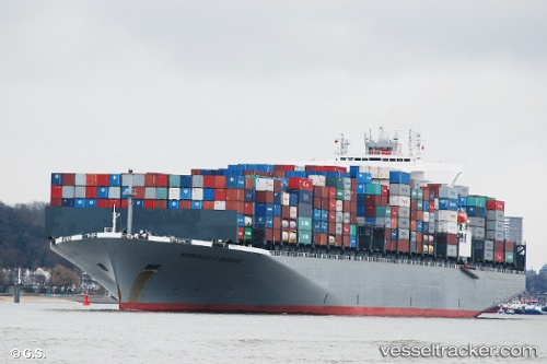
Vessel profile: ONE HONOLULU is a Container Ship with dimensions m x m.
This page combines live AIS, route history, probable destination signals, nearby traffic, and port activity for practical vessel monitoring.
The current position of vessel ONE HONOLULU is 27.95407 lat / 125.24781 lng. Updated: 2026-05-19 08:13:29 UTCNearest reference points:
- 129 nm SE of ZHOUSHAN
- 102 nm E of Wenling Longmen Port
- 165 nm SE of Lü-hua Shan
Currently sailing under the flag of Japan ![]()
Details:
Live Vessel ONE HONOLULU Analytics (details, animations, etc.)
Recent AIS points (UTC):
2026-05-19 05:03:16 UTC · 27.50347, 124.46148 · SOG 16.6 kn · COG 55°2026-05-19 06:08:22 UTC · 27.66209, 124.74097 · SOG 16.2 kn · COG 52°
2026-05-19 07:01:39 UTC · 27.79295, 124.96013 · SOG 15.7 kn · COG 53°
2026-05-19 08:13:29 UTC · 27.95407, 125.24781 · SOG 14.1 kn · COG -1°