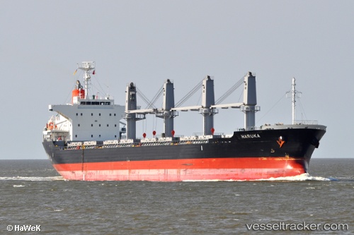
 HARUKA
Current Status
Where is the vessel?
HARUKA is currently in 23 nm S of Greenville, based on AIS data received about 14h ago.
Latest AIS update:
Current position: 4.61017° N, 9.02727° W (23 nm S of Greenville)
Average speed (last 7 days): Loading…
Average speed (last 30 days): Loading…
Vessel profile: HARUKA is a Bulk Carrier with dimensions m x m.
This page combines live AIS, route history, probable destination signals, nearby traffic, and port activity for practical vessel monitoring.
The current position of vessel HARUKA is 4.61017 lat / -9.02727 lng. Updated: 2026-05-21 00:14:04 UTCNearest reference points:
- 98 nm SW of Harper
- 15 nm SW of Buchanan
- 110 nm SW of River Cess
Currently sailing under the flag of Portugal ![]()
Details:
Live Vessel HARUKA Analytics (details, animations, etc.)
Recent AIS points (UTC):
2026-05-20 17:31:34 UTC · 5.36547, -10.19025 · SOG 13.4 kn · COG 122°2026-05-20 22:06:33 UTC · 4.83861, -9.38319 · SOG 12 kn · COG 125°
2026-05-20 22:13:54 UTC · 4.82569, -9.36281 · SOG 11.6 kn · COG 124°
2026-05-21 00:14:04 UTC · 4.61017, -9.02727 · SOG 12.2 kn · COG 126°