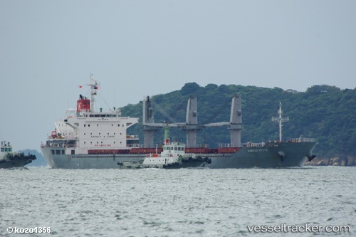
 GHANTOUT
Current Status
Where is the vessel?
GHANTOUT is currently in 11 nm NW of Rozi, based on AIS data received about 14h ago.
Latest AIS update:
Current position: 22.72621° N, 69.92681° E (11 nm NW of Rozi)
Average speed (last 7 days): Loading…
Average speed (last 30 days): Loading…
Vessel profile: GHANTOUT is a Bulk Carrier with dimensions 25m x 154m.
This page combines live AIS, route history, probable destination signals, nearby traffic, and port activity for practical vessel monitoring.
The current position of vessel GHANTOUT is 22.72621 lat / 69.92681 lng. Updated: 2026-05-21 19:43:25 UTCNearest reference points:
- 12 nm N of Rozi
- 15 nm N of Rozi
- Near SIKKA
Currently sailing under the flag of United Arab Emirates ![]()
GHANTOUT built in 2011 year
Deadweight:
23186 tDetails:
Live Vessel GHANTOUT Analytics (details, animations, etc.)
Recent AIS points (UTC):
2026-05-21 16:38:24 UTC · 22.60044, 69.70661 · SOG 10.6 kn · COG 75°2026-05-21 18:21:34 UTC · 22.72460, 69.92386 · SOG 0.7 kn · COG 33°
2026-05-21 19:31:35 UTC · 22.72653, 69.92666 · SOG 0.2 kn · COG 251°
2026-05-21 19:43:25 UTC · 22.72621, 69.92681 · SOG 0.2 kn · COG 253°