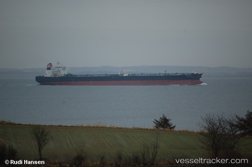
San Saba
Current StatusWhere is the vessel?
San Saba is currently in 78 nm S of San Agustin, based on AIS data received about 14h ago.
Latest AIS update:
Current position: 26.53382° N, 16.92324° W (78 nm S of San Agustin)
Average speed (last 7 days): Loading…
Average speed (last 30 days): Loading…
Vessel profile: San Saba is a Crude Oil Tanker with dimensions 48m x 274m.
This page combines live AIS, route history, probable destination signals, nearby traffic, and port activity for practical vessel monitoring.
The current position of vessel San Saba is 26.53382 lat / -16.92324 lng. Updated: 2026-05-22 22:32:04 UTCNearest reference points:
- 22 nm S of San Agustin
- 33 nm SE of San Agustin
- 110 nm NE of Las Brujas
Details:
Live Vessel San Saba Analytics (details, animations, etc.)
Recent AIS points (UTC):
2026-05-22 19:02:33 UTC · 27.17969, -16.75409 · SOG 11.3 kn · COG 192°2026-05-22 20:21:51 UTC · 26.94129, -16.79950 · SOG 10.7 kn · COG 196°
2026-05-22 22:09:32 UTC · 26.60888, -16.90026 · SOG 12.4 kn · COG 198°
2026-05-22 22:32:04 UTC · 26.53382, -16.92324 · SOG 12.5 kn · COG 199°