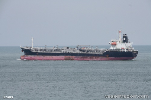
 TRANS TIND
Current Status
Where is the vessel?
TRANS TIND is currently in 27 nm SE of Mirabel, based on AIS data received about 16h ago.
Latest AIS update:
Current position: 39.54914° N, 6.66165° E (27 nm SE of Mirabel)
Average speed (last 7 days): Loading…
Average speed (last 30 days): Loading…
Vessel profile: TRANS TIND is a Oil/Chemical Tanker with dimensions m x m.
This page combines live AIS, route history, probable destination signals, nearby traffic, and port activity for practical vessel monitoring.
The current position of vessel TRANS TIND is 39.54914 lat / 6.66165 lng. Updated: 2026-05-21 22:11:00 UTCNearest reference points:
- 42 nm NE of Mirabel
- 42 nm NW of Mirabel
- 53 nm NE of San Martín De Pusa
Currently sailing under the flag of Bahamas ![]()
Details:
Live Vessel TRANS TIND Analytics (details, animations, etc.)
Recent AIS points (UTC):
2026-05-21 19:53:39 UTC · 39.31618, 7.23419 · SOG 13.2 kn · COG 297°2026-05-21 20:12:59 UTC · 39.34900, 7.15318 · SOG 13.2 kn · COG 294°
2026-05-21 21:54:59 UTC · 39.52231, 6.72993 · SOG 13.3 kn · COG 297°
2026-05-21 22:11:00 UTC · 39.54914, 6.66165 · SOG 13.2 kn · COG 299°