 GA HONG
Current Status
Where is the vessel?
GA HONG is currently in 16 nm E of HOSAN, based on AIS data received about 14h ago.
Latest AIS update:
Current position: 37.15667° N, 129.69333° E (16 nm E of HOSAN)
Average speed (last 7 days): Loading…
Average speed (last 30 days): Loading…
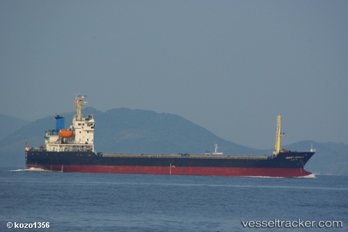
Vessel profile: GA HONG is a Cargo with dimensions m x m.
This page combines live AIS, route history, probable destination signals, nearby traffic, and port activity for practical vessel monitoring.
The current position of vessel GA HONG is 37.15667 lat / 129.69333 lng. Updated: 2026-05-19 08:34:39 UTCNearest reference points:
- 16 nm N of Yeongyang-gun
- Near DONGHAE
- 23 nm SE of Yeongyang-gun
Currently sailing under the flag of Panama ![]()
Details:
Live Vessel GA HONG Analytics (details, animations, etc.)
Recent AIS points (UTC):
2026-05-19 03:50:04 UTC · 36.20954, 129.66452 · SOG 12.6 kn · COG 1°2026-05-19 07:52:41 UTC · 37.02333, 129.66833 · SOG 11 kn · COG -1°
2026-05-19 08:34:39 UTC · 37.15667, 129.69333 · SOG 11 kn · COG -1°
2026-05-19 08:34:39 UTC · 37.15667, 129.69333 · SOG 11 kn · COG -1°