 FUAT SEZGIN
Current Status
Where is the vessel?
FUAT SEZGIN is currently in 68 nm SW of SHUAIBAH, based on AIS data received about 14h ago.
Latest AIS update:
Current position: 19.90917° N, 38.62020° E (68 nm SW of SHUAIBAH)
Average speed (last 7 days): Loading…
Average speed (last 30 days): Loading…
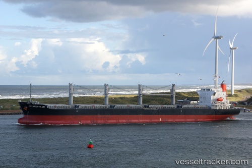
Vessel profile: FUAT SEZGIN is a Bulk Carrier with dimensions m x m.
This page combines live AIS, route history, probable destination signals, nearby traffic, and port activity for practical vessel monitoring.
The current position of vessel FUAT SEZGIN is 19.90917 lat / 38.62020 lng. Updated: 2026-05-21 17:50:01 UTCNearest reference points:
- 53 nm SW of SHUAIBAH
- Near Port Sudan
- 10 nm SW of Jeddah
Currently sailing under the flag of Marshall Islands ![]()
Details:
Live Vessel FUAT SEZGIN Analytics (details, animations, etc.)
Recent AIS points (UTC):
2026-05-21 13:55:48 UTC · 19.28733, 38.93676 · SOG 10.9 kn · COG 338°2026-05-21 16:14:07 UTC · 19.65297, 38.75090 · SOG 10.6 kn · COG 337°
2026-05-21 16:25:27 UTC · 19.68288, 38.73504 · SOG 10.6 kn · COG 337°
2026-05-21 17:50:01 UTC · 19.90917, 38.62020 · SOG 10.9 kn · COG 337°