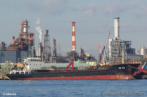
 De Pu
De Pu
Current Status
Where is the vessel?
De Pu is currently in 61 nm NW of Nanao, based on AIS data received about 15h ago.
Latest AIS update:
Current position: 37.77275° N, 136.06808° E (61 nm NW of Nanao)
Average speed (last 7 days): Loading…
Average speed (last 30 days): Loading…
Vessel profile: De Pu is a General Cargo Ship with dimensions 98m x 16m.
This page combines live AIS, route history, probable destination signals, nearby traffic, and port activity for practical vessel monitoring.
The current position of vessel De Pu is 37.77275 lat / 136.06808 lng. Updated: 2026-05-20 05:26:48 UTCNearest reference points:
- Near Toyama
- 63 nm NW of Sado Shima Apt
- 15 nm NW of SHIMONOHAMA
Currently sailing under the flag of Panama ![]()
De Pu built in 2010 year
Deadweight:
6546 tDetails:
Live Vessel De Pu Analytics (details, animations, etc.)
Recent AIS points (UTC):
2026-05-20 01:40:21 UTC · 37.45414, 135.41637 · SOG 9.3 kn · COG -1°2026-05-20 03:35:57 UTC · 37.61459, 135.74538 · SOG 9.7 kn · COG 61°
2026-05-20 04:14:08 UTC · 37.66893, 135.85519 · SOG 9.6 kn · COG 61°
2026-05-20 05:26:48 UTC · 37.77275, 136.06808 · SOG 9.7 kn · COG 61°