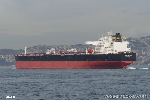
 NANTUCKET
Current Status
Where is the vessel?
NANTUCKET is currently in 162 nm W of Henties Bay (Hentiesbaai), based on AIS data received about 14h ago.
Latest AIS update:
Current position: 21.70559° S, 11.40350° E (162 nm W of Henties Bay (Hentiesbaai))
Average speed (last 7 days): Loading…
Average speed (last 30 days): Loading…
Vessel profile: NANTUCKET is a Crude Oil Tanker with dimensions 275m x 48m.
This page combines live AIS, route history, probable destination signals, nearby traffic, and port activity for practical vessel monitoring.
The current position of vessel NANTUCKET is -21.70559 lat / 11.40350 lng. Updated: 2026-05-19 17:21:21 UTCNearest reference points:
- 151 nm W of Henties Bay (Hentiesbaai)
- 161 nm W of Walvisbaai
Currently sailing under the flag of Liberia ![]()
NANTUCKET built in 2014 year
Deadweight:
156902 tDetails:
Live Vessel NANTUCKET Analytics (details, animations, etc.)
Recent AIS points (UTC):
2026-05-19 13:37:12 UTC · -22.32198, 11.59941 · SOG 10.4 kn · COG 344°2026-05-19 15:56:46 UTC · -21.93500, 11.47667 · SOG 10 kn · COG -1°
2026-05-19 16:17:49 UTC · -21.87833, 11.45833 · SOG 10 kn · COG -1°
2026-05-19 17:21:21 UTC · -21.70559, 11.40350 · SOG 10.1 kn · COG 342°