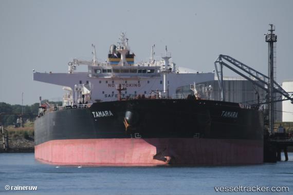
 TAMARA
Current Status
Where is the vessel?
TAMARA is currently in 12 nm N of Port Said, based on AIS data received about 15h ago.
Latest AIS update:
Current position: 31.47416° N, 32.32615° E (12 nm N of Port Said)
Average speed (last 7 days): Loading…
Average speed (last 30 days): Loading…
Vessel profile: TAMARA is a Crude Oil Tanker with dimensions 275m x 48m.
This page combines live AIS, route history, probable destination signals, nearby traffic, and port activity for practical vessel monitoring.
The current position of vessel TAMARA is 31.47416 lat / 32.32615 lng. Updated: 2026-05-20 17:57:46 UTCNearest reference points:
- 14 nm N of Port Said
- 16 nm N of Port Said
- 15 nm N of Port Said
Currently sailing under the flag of Liberia ![]()
TAMARA built in 2015 year
Deadweight:
157016 tDetails:
Live Vessel TAMARA Analytics (details, animations, etc.)
Recent AIS points (UTC):
2026-05-20 13:50:06 UTC · 31.51177, 32.24234 · SOG 8.7 kn · COG 129°2026-05-20 15:54:43 UTC · 31.47430, 32.32628 · SOG 0 kn · COG 310°
2026-05-20 16:09:47 UTC · 31.47439, 32.32637 · SOG 0.1 kn · COG 303°
2026-05-20 17:57:46 UTC · 31.47416, 32.32615 · SOG 0 kn · COG 314°