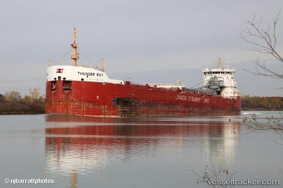
 Thunder Bay
Current Status
Where is the vessel?
Thunder Bay is currently in 18 nm E of Ossineke, based on AIS data received about 16h ago.
Latest AIS update:
Current position: 44.91709° N, 83.00789° W (18 nm E of Ossineke)
Average speed (last 7 days): Loading…
Average speed (last 30 days): Loading…
Vessel profile: Thunder Bay is a Self Discharging Bulk Carrier with dimensions 225m x 24m.
This page combines live AIS, route history, probable destination signals, nearby traffic, and port activity for practical vessel monitoring.
The current position of vessel Thunder Bay is 44.91709 lat / -83.00789 lng. Updated: 2026-05-18 17:29:26 UTCNearest reference points:
- Near Meldrum
- Near Mackinaw City
- Near Fort Gratiot
Currently sailing under the flag of Canada ![]()
Thunder Bay built in 2013 year
Deadweight:
34433 tDetails:
Live Vessel Thunder Bay Analytics (details, animations, etc.)
Recent AIS points (UTC):
2026-05-18 13:47:11 UTC · 44.19259, -82.68225 · SOG 12.3 kn · COG 343°2026-05-18 15:34:24 UTC · 44.54213, -82.83967 · SOG 12.4 kn · COG 343°
2026-05-18 16:42:31 UTC · 44.76500, -82.93833 · SOG 12 kn · COG -1°
2026-05-18 17:29:26 UTC · 44.91709, -83.00789 · SOG 12.4 kn · COG 341°