 MSC NAIROBI X
Current Status
Where is the vessel?
MSC NAIROBI X is currently in Near TANGER MED, based on AIS data received about 14h ago.
Latest AIS update:
Current position: 35.99217° N, 5.43259° W (Near TANGER MED)
Average speed (last 7 days): Loading…
Average speed (last 30 days): Loading…
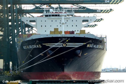
Vessel profile: MSC NAIROBI X is a Container Ship with dimensions m x m.
This page combines live AIS, route history, probable destination signals, nearby traffic, and port activity for practical vessel monitoring.
The current position of vessel MSC NAIROBI X is 35.99217 lat / -5.43259 lng. Updated: 2026-05-19 12:26:26 UTCNearest reference points:
- Near TANGER MED
- Near Algeciras
- Near TARIFA
Currently sailing under the flag of Liberia ![]()
Details:
Live Vessel MSC NAIROBI X Analytics (details, animations, etc.)
Recent AIS points (UTC):
2026-05-19 07:53:02 UTC · 36.19689, -3.91690 · SOG 17.4 kn · COG 262°2026-05-19 10:12:26 UTC · 36.10604, -4.68394 · SOG 16.3 kn · COG 266°
2026-05-19 10:55:02 UTC · 36.09847, -4.92841 · SOG 17.2 kn · COG 258°
2026-05-19 12:26:26 UTC · 35.99217, -5.43259 · SOG 16.4 kn · COG 254°