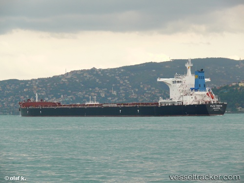
Flag Thenia
Current StatusWhere is the vessel?
Flag Thenia is currently in 94 nm SE of Okao, based on AIS data received about 14h ago.
Latest AIS update:
Current position: 4.91333° S, 117.41500° E (94 nm SE of Okao)
Average speed (last 7 days): Loading…
Average speed (last 30 days): Loading…
Vessel profile: Flag Thenia is a Bulk Carrier with dimensions 45m x 292m.
This page combines live AIS, route history, probable destination signals, nearby traffic, and port activity for practical vessel monitoring.
The current position of vessel Flag Thenia is -4.91333 lat / 117.41500 lng. Updated: 2026-05-18 21:57:56 UTCNearest reference points:
- 117 nm W of Panakukang
- 70 nm S of MEKAR PUTIH
- 74 nm NE of Pagerungan
Details:
Live Vessel Flag Thenia Analytics (details, animations, etc.)
Recent AIS points (UTC):
2026-05-18 18:12:55 UTC · -4.38167, 117.74667 · SOG 9 kn · COG -1°2026-05-18 19:43:55 UTC · -4.59500, 117.61734 · SOG 9.8 kn · COG -1°
2026-05-18 19:51:54 UTC · -4.61333, 117.60500 · SOG 9 kn · COG -1°
2026-05-18 21:57:56 UTC · -4.91333, 117.41500 · SOG 9 kn · COG -1°