 vesseltracker.com
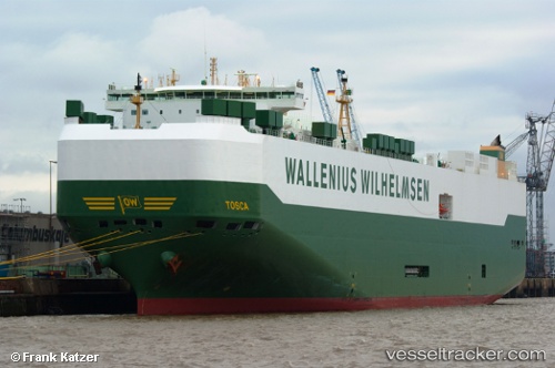
 TOSCA
TOSCA
Current Status
Where is the vessel?
TOSCA is currently in 30 nm SE of Deadmans Cay, based on AIS data received about 15h ago.
Latest AIS update:
Current position: 22.85667° N, 74.65833° W (30 nm SE of Deadmans Cay)
Average speed (last 7 days): Loading…
Average speed (last 30 days): Loading…
Vessel profile: TOSCA is a Vehicles Carrier with dimensions m x m.
This page combines live AIS, route history, probable destination signals, nearby traffic, and port activity for practical vessel monitoring.
The current position of vessel TOSCA is 22.85667 lat / -74.65833 lng. Updated: 2026-05-18 08:15:03 UTCNearest reference points:
- Near Great Exuma Island
- 30 nm SW of Cape Eleuthera
- 29 nm SW of Cape Eleuthera
Currently sailing under the flag of Norway ![]()
Details:
Live Vessel TOSCA Analytics (details, animations, etc.)
Recent AIS points (UTC):
2026-05-18 04:33:04 UTC · 23.63167, -74.65333 · SOG 13 kn · COG -1°2026-05-18 05:54:01 UTC · 23.34500, -74.65833 · SOG 12 kn · COG -1°
2026-05-18 06:51:03 UTC · 23.14833, -74.66333 · SOG 12 kn · COG -1°
2026-05-18 08:15:03 UTC · 22.85667, -74.65833 · SOG 12 kn · COG -1°