 vesseltracker.com
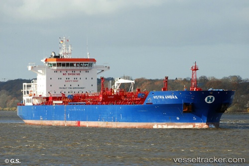
 Histria Ambra
Current Status
Where is the vessel?
Histria Ambra is currently in 74 nm SE of Kárpathos, based on AIS data received about 1h ago.
Latest AIS update:
Current position: 34.53684° N, 28.17910° E (74 nm SE of Kárpathos)
Average speed (last 7 days): Loading…
Average speed (last 30 days): Loading…
Vessel profile: Histria Ambra is a Chemical Oil Products Tanker with dimensions 180m x 32m.
This page combines live AIS, route history, probable destination signals, nearby traffic, and port activity for practical vessel monitoring.
The current position of vessel Histria Ambra is 34.53684 lat / 28.17910 lng. Updated: 2026-05-18 02:19:17 UTCNearest reference points:
- 108 nm S of Kastellorizou (ex Megísti)
- 91 nm SE of Polychnitos Lesvou
- 129 nm NW of ABU QIR
Currently sailing under the flag of Liberia ![]()
Histria Ambra built in 2013 year
Deadweight:
40345 tDetails:
Live Vessel Histria Ambra Analytics (details, animations, etc.)
Recent AIS points (UTC):
2026-05-17 23:05:18 UTC · 34.00165, 28.43978 · SOG 10.7 kn · COG 335°2026-05-17 23:40:28 UTC · 34.09835, 28.39186 · SOG 10.7 kn · COG 335°
2026-05-18 02:17:37 UTC · 34.53237, 28.18132 · SOG 10.6 kn · COG 335°
2026-05-18 02:19:17 UTC · 34.53684, 28.17910 · SOG 10.6 kn · COG 336°