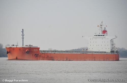
 FIESTA
Current Status
Where is the vessel?
FIESTA is currently in Open sea, approx. 551 nm off the nearest listed port, based on AIS data received about 14h ago.
Latest AIS update:
Current position: 10.92666° S, 62.62500° E (Open sea, approx. 551 nm off the nearest listed port)
Average speed (last 7 days): Loading…
Average speed (last 30 days): Loading…
Vessel profile: FIESTA is a Cargo with dimensions m x m.
This page combines live AIS, route history, probable destination signals, nearby traffic, and port activity for practical vessel monitoring.
The current position of vessel FIESTA is -10.92666 lat / 62.62500 lng. Updated: 2026-05-19 22:01:48 UTCNearest reference points:
- Open sea, approx. 551 nm off the nearest listed port
- Open sea, approx. 549 nm off the nearest listed port
- Open sea, approx. 550 nm off the nearest listed port
Currently sailing under the flag of Liberia ![]()
Details:
Live Vessel FIESTA Analytics (details, animations, etc.)
Recent AIS points (UTC):
2026-05-19 19:30:12 UTC · -10.59413, 63.00993 · SOG 11.9 kn · COG 229°2026-05-19 19:50:28 UTC · -10.63780, 62.95714 · SOG 12 kn · COG 229°
2026-05-19 21:40:49 UTC · -10.87833, 62.67667 · SOG 11 kn · COG -1°
2026-05-19 22:01:48 UTC · -10.92666, 62.62500 · SOG 12 kn · COG -1°