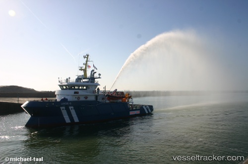
Glomar Linde
Current StatusWhere is the vessel?
Glomar Linde is currently in 40 nm SW of Neeltje Jans, based on AIS data received about 15h ago.
Latest AIS update:
Current position: 53.16733° N, 2.88922° E (40 nm SW of Neeltje Jans)
Average speed (last 7 days): Loading…
Average speed (last 30 days): Loading…
Vessel profile: Glomar Linde is a Standby Safety Vessel with dimensions 11m x 42m.
This page combines live AIS, route history, probable destination signals, nearby traffic, and port activity for practical vessel monitoring.
The current position of vessel Glomar Linde is 53.16733 lat / 2.88922 lng. Updated: 2026-05-19 13:35:55 UTCNearest reference points:
- 24 nm NE of Caister on Sea
- Near Craven Arms
- 19 nm NW of Neeltje Jans
Details:
Live Vessel Glomar Linde Analytics (details, animations, etc.)
Recent AIS points (UTC):
2026-05-19 10:27:56 UTC · 53.18267, 2.89649 · SOG 3.2 kn · COG 327°2026-05-19 11:57:35 UTC · 53.21374, 2.87893 · SOG 2.5 kn · COG 154°
2026-05-19 13:09:56 UTC · 53.18081, 2.88778 · SOG 2.2 kn · COG 164°
2026-05-19 13:35:55 UTC · 53.16733, 2.88922 · SOG 1.6 kn · COG 164°