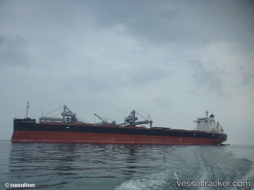
Santa Emilia
Current StatusWhere is the vessel?
Santa Emilia is currently in Near Bay Point, based on AIS data received about 14h ago.
Latest AIS update:
Current position: 38.03191° N, 121.87015° W (Near Bay Point)
Average speed (last 7 days): Loading…
Average speed (last 30 days): Loading…
Vessel profile: Santa Emilia is a Bulk Carrier with dimensions 32m x 224m.
This page combines live AIS, route history, probable destination signals, nearby traffic, and port activity for practical vessel monitoring.
The current position of vessel Santa Emilia is 38.03191 lat / -121.87015 lng. Updated: 2026-05-19 03:23:27 UTCNearest reference points:
- Near Benicia
- Near Isleton
- Near VALLEJO
Details:
Live Vessel Santa Emilia Analytics (details, animations, etc.)
Recent AIS points (UTC):
2026-05-19 00:05:27 UTC · 38.03189, -121.87013 · SOG 0 kn · COG 297°2026-05-19 01:53:27 UTC · 38.03189, -121.87013 · SOG 0 kn · COG 297°
2026-05-19 02:29:27 UTC · 38.03189, -121.87014 · SOG 0 kn · COG 297°
2026-05-19 03:23:27 UTC · 38.03191, -121.87015 · SOG 0 kn · COG 297°